v18.2 [Oct 18, 2018]
General
- New module allows access to Congeria.
- New module for managing topology regulations.
CAD
- ALT C closes selected lines.
- New command for joining surfaces.
- New command for subtracting surfaces.
- New command for dividing surfaces with a line.
- New command for snapping polyline to nearby points.
- Possible to display lineweights in drawing sheets according to HMK.
- Create polyline command has an option to cut the new polyline from overlapping polygons.
- Create polyline command has an option to enlarge other topology layers.
- Create drawing sheet command can use another sheet as template.
- Possible to edit multiple symbols or linetypes simultaneously in legend editor.
- Possible to choose attribute for text when converting text to points.
- Improved raster handling.
Macro
- Possible to edit macros in a grid.
Survey
- New calculation functions for surveying 3D objects.
- Import of Topcon (*.mxl) supported.
Import/Export
- Improved export to SOSI (*.sos).
- Export to Shape (*.shp) now also creates coordinate system/projection file (*.prj).
- Correction: Attributes were not imported correctly from MapInfo.
- Import of civil plan according to SS 637040 standard (*.xml).
- Export of calculated section terrace to Georog line model (*.lmd).
Point cloud
- New function for finding buildings.
Profile
- Objects can be separated into different layers when inserting profile form into drawing.
Calculated sections
- Objects can be separated into different layers when inserting section drawings into drawing.
FDO
- Possible to add topology regulation to map.
v14.1 [Jun 7, 2012]
- New module for connection to EspaCity.
- Selectable on crosshairs to invert the background or drawn with a solid color.
- Reduced flicker when the crosshairs move.
- New tool box to go to the optional step of undo / redo.
v13.2 [Jul 18, 2011]
Possibility to specify which font and what size should be standard for texts (Systems/Project Settings/Drawing).
Correction: The software could crash when drawing was saved, if objects with associative dimensions had been deleted.
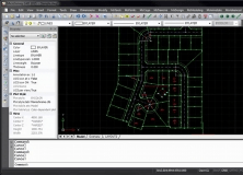


A desktop survey and design program created for surveyors, and contractors.